|
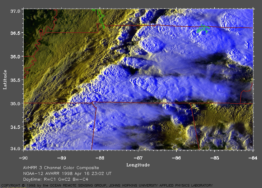
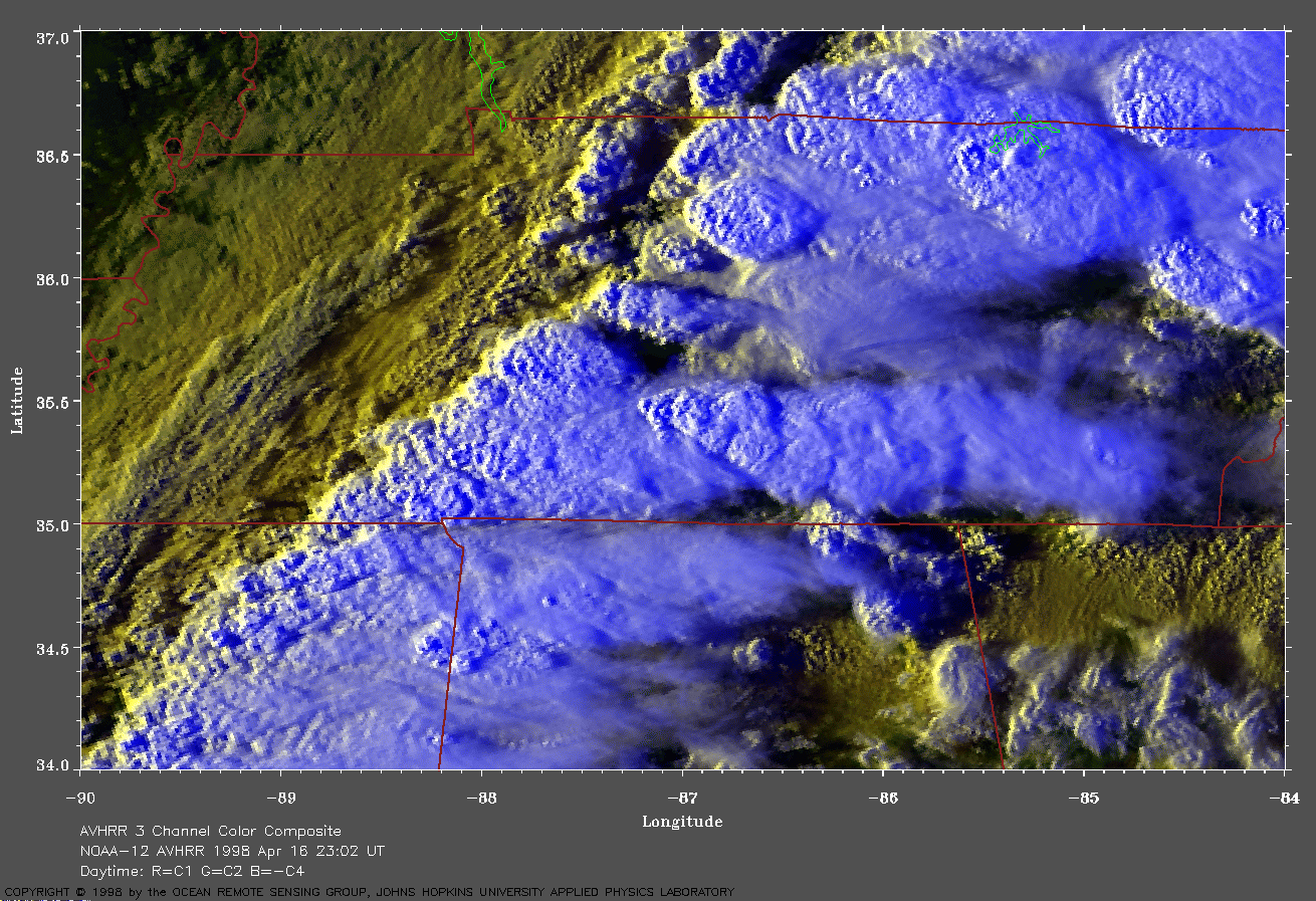
Tennessee on 16 April 1998 In this image, the warmer (and lower) clouds are yellow. The cooler (and higher) clouds are white. A very large image (673 Kb) of this area is available here. |
 Click on image for larger view (341 Kb).
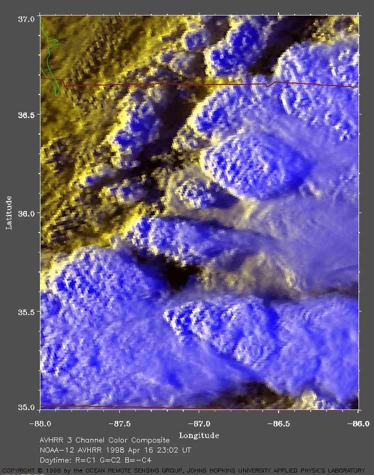
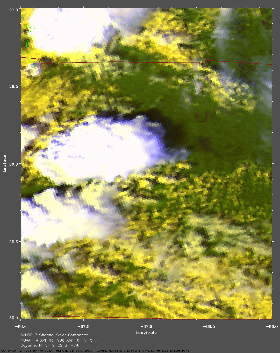
Nashville area on 16 April 1998 A very large image (687 Kb) of this area is available here. Note the small cloud extending from the southeast corner of the supercell. The Cumberland River is visible in this image. Nashville is located at about 36.20N, 86.77W. |
|
At 1230 am CDT on 16 April 1998, the National Weather Service (NWS) reported an area of low pressure centered over west central Illinois with an associated warm front extending across central Indiana into central Ohio. The associated cold front extended southwest across central Missouri into north central Texas. This cold front was wavy and slow moving. Lightning detectors and radar showed a line of thunderstorms extending from western Ohio across to north Texas. An upper level low was centered over southern Minnesota. Strong southeasterly flow was bringing low-level moisture ahead of this cold front. This moisture was resulting in dew points in the upper 60's F. Moist air is more buoyant than dry air and helps to enhance convection. The surface temperatures were predicted to be in the 70's and low 80's F. The NWS predicted a moderately unstable airmass with surface-based CAPE values near 2500 J/kg to develop in the Tennessee area. The outflow boundaries from the thunderstorms already occurring in this area would provide the focus for further convective development. The NWS predicted that the Ohio, Tennessee, and Mississippi valleys had the potential for severe thunderstorms during the following 24 hours. In addition, strong mid-level winds associated with a shortwave trough were moving eastward from Oklahoma into the region. The NWS noted that these winds were drying the mid-levels and should aid downdraft potential. The NWS forecast that this would result in thunderstorms with bow echoes, damaging wind gusts, and possibly bow head tornadoes. The NWS also predicted that the height of zero wet bulb temperature (0 C) would lower across this area and, with the instability, would result in large hail. At 2:00 AM CDT, satellite and radar imagery showed heavy convective rains extending from Arkansas along the Ohio River valley. An upper level diffluent pattern between the strong northern and southern jet streams would further enhance the upward lift associated with the moist, unstable air mass over Tennessee. At about this same time, this storm system was already producing tornadoes that killed people in eastern Arkansas and western Tennessee (note: NWS had issued tornado watch number 222 at 11:45 CDT on 15 April for northeastern and central Arkansas, the Missouri bootheel, and western Tennessee). At 4:00 AM CDT, the NWS issued tornado watch number 225 for central and western Tennessee. Wind profiles were favorable for supercell storms. A mesolow formed and was moving along the Tennessee/Kentucky border, enhancing low level shear. Cumulonimbus clouds had developed with tops up to 45,000 ft altitude. At 6:30 AM CDT, the NWS issued tornado watch number 226 for middle and eastern Tennessee and southeast Kentucky. The meso-low was continuing to move slowly along the Tennessee/Kentucky border. Helicity values approached 500 m2/s2 although the level of instability was decreasing somewhat. Wind profiles showed unidirectional winds over middle Tennessee behind the initial band of convection. Upstream, additional thunderstorms were predicted to develop and spread eastward into western Tennessee over the next two hours. At 7:20 AM CDT, the NWS reported thunderstorms continuing to develop over Arkansas. Some of these thunderstorms had bow echoes. The damaging wind and hail threat was increasing as a shortwave trough approached the area. At 8:24 AM CDT, the NWS reported a tornado in the Nashville area. The NWS expressed increasing concern about a supercell moving into northern Monroe County, Arkansas, because it was approaching an area of higher instability. A thunderstorm outflow boundary moving slowly south across central Tennessee was producing strong and severe thunderstorms in which the low level inflow was nearly perpendicular to the outflow. The wind profile showed a relative helicity of about 300 m2/s2. The NWS concluded that storms developing along the outflow boundary would continue to have tornado potential for the next few hours. At 9:49 AM CDT, the NWS issued a new tornado watch for middle and western Tennessee, northern Mississippi, eastern Arkansas, and northern Alabama. This tornado watch number 228 replaced tornado watch number number 225 and severe thunderstorm watch number 227. Upper air analyses showed 500 hPa winds from the west-southwest in excess of 70 knots. Cumulonimbus clouds were reported with tops up to 48,000 ft. Surface dew points had risen into the low 70's F across the region. A narrow area of clear skies was expected to provide sufficient surface heating for even greater instability by mid-afternoon. At 10:37 AM CDT, wind damage was reported at Adams, Tennessee. Three distinct supercells were located within the tornado watch number 228 area. Wind profiles now showed that elative helicity values had increased to 300-500 m2/s2. Surface heating continued to raise surface-based CAPE values to 1500 J/kg along and south of the east-west oriented convection boundary. By noon CDT, surface temperatures in eastern Arkansas had risen into the low 80's F. Surface-based CAPE values in this area had risen to over 3000 J/kg and helicities were near 500 m2/s2. The NWS predicted that explosive development would occur within the next few hours. A 1:37 PM CDT, supercells were continuing to develop upstream across middle and western Tennessee. Quarter-size hail was reported in central Tennessee. The NWS reported that wind profiles from Memphis and Nashville, Tennessee, showed relative helicity values of 300-500 m2/s2 and surface-based CAPE values of 2000-3000 J/kg. The 500 hPa jet was bringing dry air from the west-southwest into the area. The slow-moving cold front was now beginning to move into western Tennessee. At 2:30 PM CDT, the NWS reported several supercells rapidly developing and intensifying over western Tennessee. These supercells were centered along an axis of maximum instability in which the surface-based CAPE values were 2500-3500 J/kg. Doppler radar showed impressive vertical wind shear with the 500 hPa winds now at 75 knots. The relative helicity was about 400 m2/s2. One inch hail was reported near Parsons, Tennessee. At 3:21 PM CDT, the NWS replaced the previous tornado watches (228 and 230) with tornado watch number 232 for all of Tennessee and western North Carolina. At this time, the outflow boundary had stalled as a roughly east-west line across Tennessee. Surface wind gusts up to 70 knots had been reported. The high level jet streak approaching this area from eastern Arkansas would further enhance convergence. Wind damage was reported from numerous thunderstorms over Tennessee and the surrounding states. A tornado was reported at 3:32 PM CDT in the city of Nashville. The tornado skipped across downtown Nashville causing serious property damage and numerous injuries. |
|
Click on image for larger view (323 Kb).
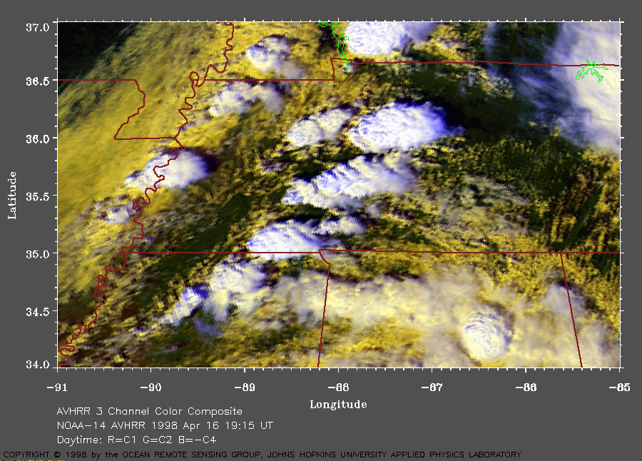
Tennessee on 16 April 1998 In this image, the warmer (and lower) clouds are yellow. The cooler (and higher) clouds are white. A very large image (702 Kb) of this area is available here. |
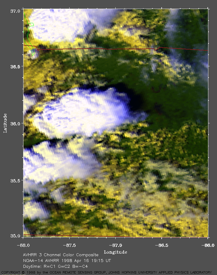
 Click on image for larger view (362 Kb).
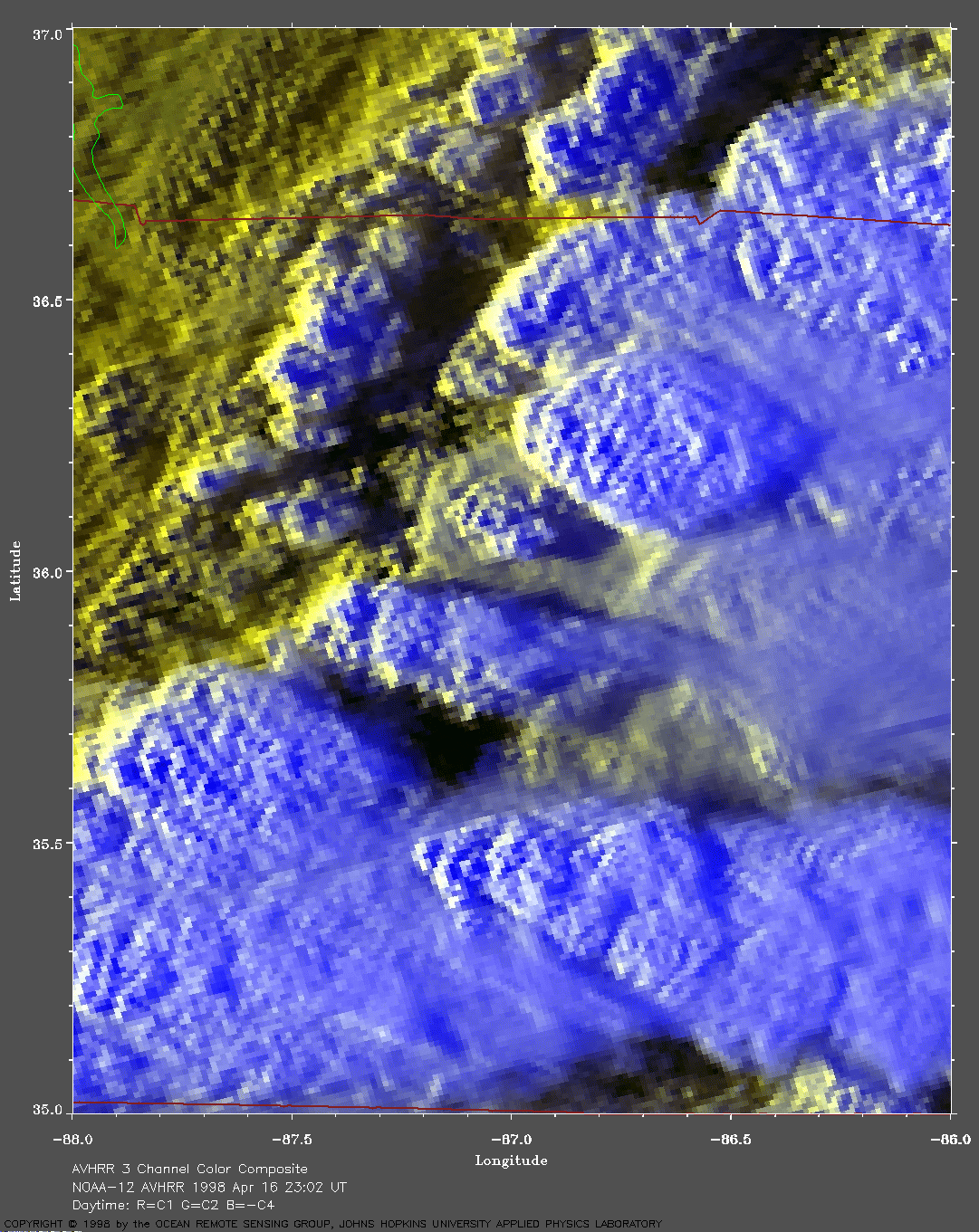
Nashville area on 16 April 1998 Nashville is located at about 36.20N, 86.77W. A very large image (748 Kb) of this area is available here. |
|
GOES-8 images from the University of Wisconsin. |
Other information: Federal Emergency Management Agency For more interesting satellite AVHRR images, return to the index page. |